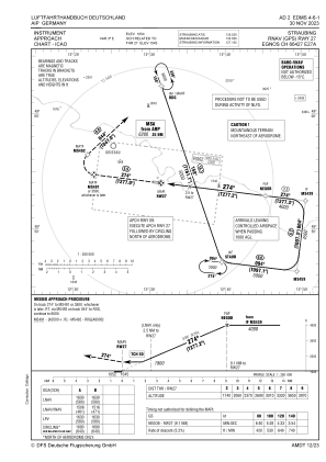
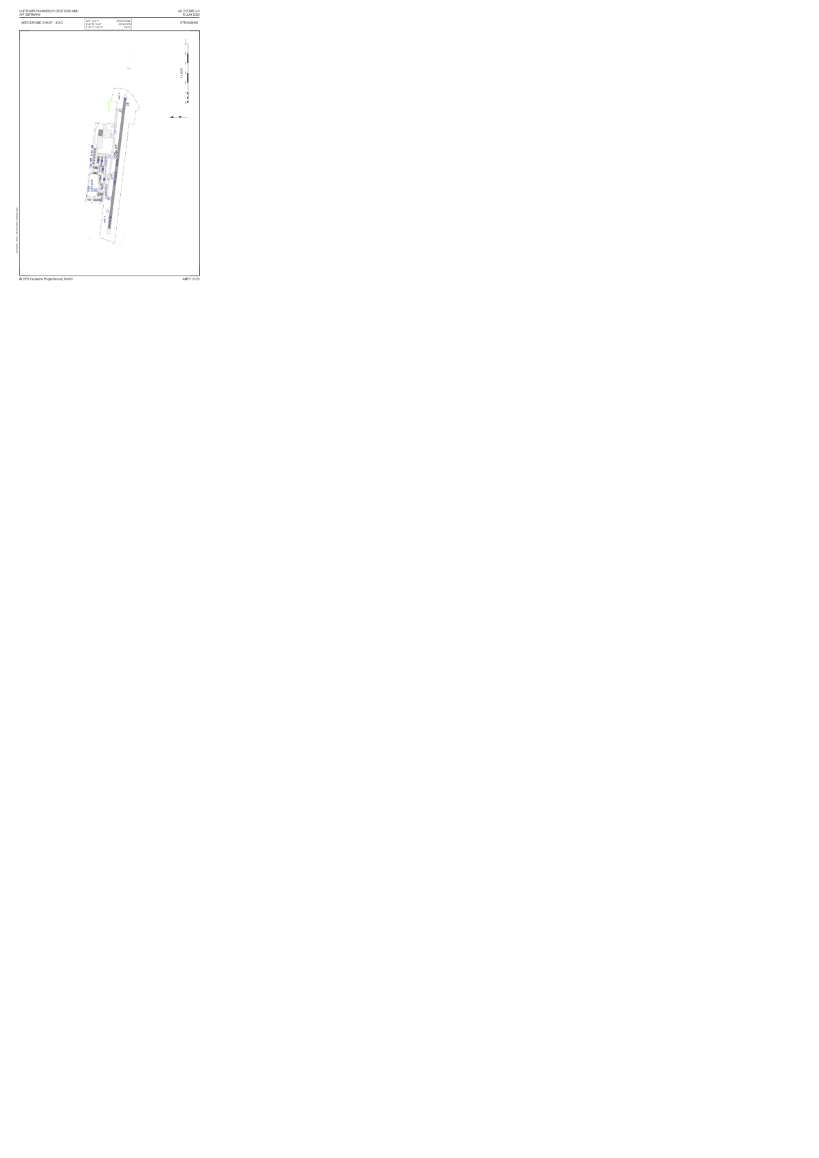


EDMS - Straubing
Located in Straubing, Germany
ICAO - EDMS, IATA - RBM
Data provided by AirmateGeneral information
Coordinates: N48°54'3" E12°31'5"
Elevation is 1053 feet MSL.
Magnetic variation is 3.3900° East View others Airports in Bavaria
Operational data
Special qualification required
Current time UTC:
Current local time:
Weather at : ETIH - Hohenfels Aaf ( 61 km )
METAR: ETIH 172155Z AUTO 20004KT 9999 -DZ FEW013 SCT025 BKN038 11/09 A2982 RMK AO2 RAE2058DZB2058E03DZB25E30RAB30E40DZB40E44DZB54 SLP102 P0000 T01070086 401470105 $
Communications frequencies: [VIEW]
Runways:
| RWY identifier | QFU | Length (ft) | Width (ft) | Surface | LDA (ft) |
| 09 | 97° | 4429 | 98 | ASPH | 4101 |
| 27 | 277° | 4429 | 98 | ASPH | 4429 |
Airport contact information
Address: Straubing Germany
Handlers

Other aviation service providers
Aviation club (not for profit)

Fliegerclub Straubing-Wallmühle E.V.
Fliegerclub Straubing-Wallmühle E.V.
sepp.breu@gmx.de+491718527187
+491718527187
+491718527187