


CYQD - The Pas
Located in , Canada
ICAO - CYQD, IATA - YQD
Data provided by AirmateGeneral information
Coordinates: N53°58'17" W101°5'28"
Elevation is 888 feet MSL.
Magnetic variation is 6.1211° East View others Airports in Manitoba
Operational data
Special qualification required
Current time UTC:
Current local time:
Weather
METAR: CYQD 100000Z AUTO 04006G15KT 360V070 9SM CLR 14/04 A2993 RMK SLP146 DENSITY ALT 1100FT
TAF: TAF AMD CYQD 092229Z 0922/1007 25015G25KT P6SM BKN100 TEMPO 0922/1006 P6SM -SHRA BKN060 BECMG 0922/0924 30010KT FM100600 30010KT P6SM SCT080 RMK FCST BASED ON AUTO OBS. NXT FCST BY 100100Z
Communications frequencies: [VIEW]
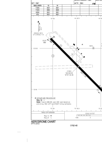
Runways:
| RWY identifier | QFU | Length (ft) | Width (ft) | Surface | LDA (ft) |
| 13 | 135° | 5901 | 150 | ASPH | 5901 |
| 31 | 315° | 5901 | 150 | ASPH | 5901 |
Airport contact information
Address: Canada