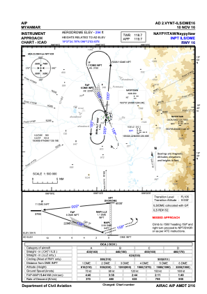
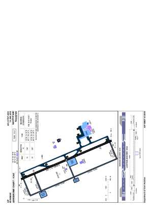


VYNT - Naypyitaw Intl
Located in Naypyitaw, Myanmar
ICAO - VYNT, IATA - NYT
Data provided by AirmateGeneral information
Coordinates: N19°37'25" E96°12'4"
Elevation is 295 feet MSL.
View others Airports in Shan State
Operational data
Special qualification required
Current time UTC:
Current local time:
Weather
TAF: TAF VYNT 081100Z 0812/0912 27008KT 7000 SCT020 FEW025CB SCT120 TEMPO 0812/0818 23008KT 5000 -TSRA BKN018 FEW023CB BKN110
Communications frequencies: [VIEW]
Runways:
| RWY identifier | QFU | Length (ft) | Width (ft) | Surface | LDA (ft) |
| 16 | 158° | 11998 | 200 | UNK | |
| 34 | 338° | 11998 | 200 | UNK |
Airport contact information
Address: Naypyitaw Myanmar