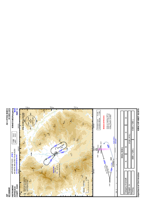
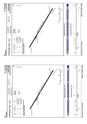


VYKG - Kengtung
Located in Kengtung, Myanmar
ICAO - VYKG, IATA - KET
Data provided by AirmateGeneral information
Coordinates: N21°18'6" E99°38'9"
Elevation is 2705 feet MSL.
View others Airports in Shan State
Operational data
Special qualification required
Current time UTC:
Current local time:
Weather at : - ( 0 km )
METAR: ZMUB 130600Z 34009MPS 310V010 9999 FEW033 SCT100 11/M00 Q1018 NOSIG RMK QFE655.9 44 MOP
Communications frequencies: [VIEW]
Runways:
| RWY identifier | QFU | Length (ft) | Width (ft) | Surface | LDA (ft) |
| 12 | 122° | 7999 | 151 | ASP | |
| 30 | 302° | 7999 | 151 | ASP |
Airport contact information
Address: Kengtung Myanmar