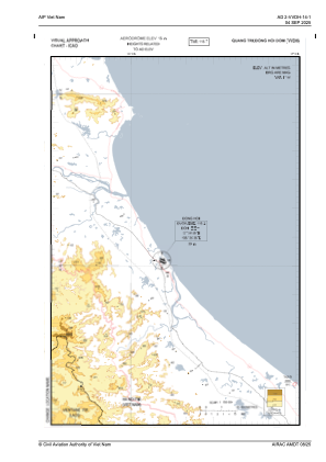
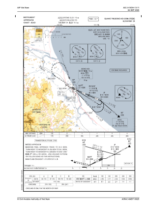
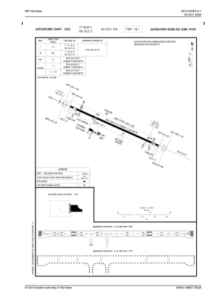


VVDH - Quang Binh/Dong Hoi
Located in Dong Hoi, Viet Nam
ICAO - , IATA -
Data provided by AirmateGeneral information
Coordinates: N17°30'55" E106°35'27"
Elevation is 59 feet MSL.
View others Airports in Quang Binh
Operational data
Special qualification required
Current time UTC:
Current local time:
Weather at : - ( 0 km )
METAR: CYAT 150236Z AUTO 33006KT 2 1/2SM -SN BKN014 OVC021 00/M01 A3007 RMK VIS VRB 1 1/2-3 SLP187
Communications frequencies: [VIEW]
Runways:
| RWY identifier | QFU | Length (ft) | Width (ft) | Surface | LDA (ft) |
| 11 | 114° | 7874 | 148 | UNK | |
| 29 | 294° | 7874 | 148 | UNK |
Airport contact information
Address: Dong Hoi Viet Nam