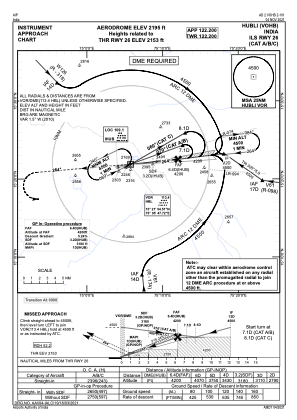
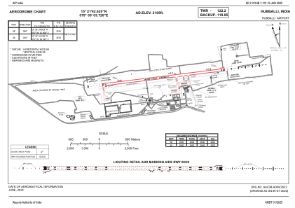


VOHB - Hubballi Airport, Hubballi
Located in Hubballi, India
ICAO - , IATA - HBX
Data provided by AirmateGeneral information
Coordinates: N15°21'43" E75°5'4"
Elevation is 2195 feet MSL.
View others Airports in Karnataka
Operational data
Special qualification required
Current time UTC:
Current local time:
Weather
TAF: TAF VOHB 211400Z 2115/2124 VRB02KT 6000 SCT012 SCT080 TEMPO 2115/2118 3000 TSRA RA SCT012 SCT020 FEW025CB BKN080
Communications frequencies: [VIEW]
Runways:
| RWY identifier | QFU | Length (ft) | Width (ft) | Surface | LDA (ft) |
| 08 | 83° | 8530 | 148 | UNK | |
| 26 | 263° | 8530 | 148 | UNK |
Airport contact information
Address: Hubballi India