


VIAR - Sri Guru Ram Dass Jee International Airport, Amritsar
Located in Amritsar, India
ICAO - VIAR, IATA - ATQ
Data provided by AirmateGeneral information
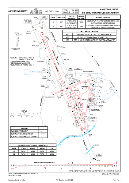
Coordinates: N31°42'38" E74°48'1"
Elevation is 758 feet MSL.
View others Airports in Punjab
Operational data
Special qualification required
Current time UTC:
Current local time:
Weather
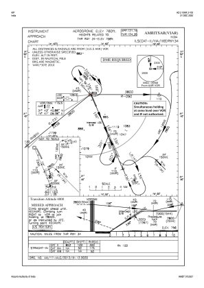
METAR: VIAR 211030Z 20007KT 5000 HZ NSC 43/13 Q1001 NOSIG
TAF: TAF VIAR 210800Z 2109/2118 17005KT 6000 NSC BECMG 2115/2117 35008KT 5000 HZ FEW100
Communications frequencies: [VIEW]
Runways:
| RWY identifier | QFU | Length (ft) | Width (ft) | Surface | LDA (ft) |
| 16 | 158° | 12001 | 148 | ASP | |
| 34 | 338° | 12001 | 148 | ASP |
Airport contact information
Address: Amritsar India