


VERP - Swami Vivekananda Airport, Raipur
Located in Raipur, India
ICAO - , IATA - RPR
Data provided by AirmateGeneral information
Coordinates: N21°10'52" E81°44'19"
Elevation is 1041 feet MSL.
View others Airports in Chhattisgarh
Operational data
Special qualification required
Current time UTC:
Current local time:
Weather
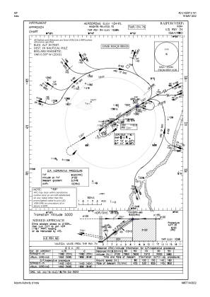
METAR: VERP 211830Z 12012KT 3000 HZ SCT020 BKN100 28/21 Q1005 NOSIG
TAF: TAF VERP 211700Z 2118/2224 15005KT 4000 HZ FEW020 SCT100 BECMG 2203/2204 22005KT 5000 HZ TEMPO 2210/2214 VRB03KT 4000 -TSRA/HZ SCT020 FEW030CB BKN090 BECMG 2215/2216 VRB03KT 4000 HZ SCT020 SCT100
Communications frequencies: [VIEW]
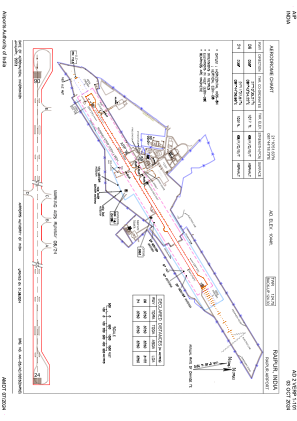
Runways:
| RWY identifier | QFU | Length (ft) | Width (ft) | Surface | LDA (ft) |
| 06 | 59° | 7493 | 148 | UNK | |
| 24 | 239° | 7493 | 148 | UNK |
Airport contact information
Address: Raipur India