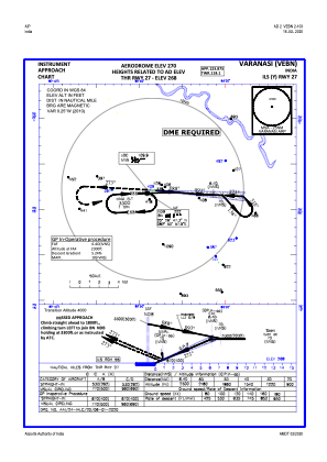
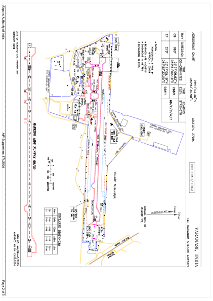


VEBN - Lal Bahadur Shastri Airport, Varanasi
Located in Varanasi, India
ICAO - , IATA - VNS
Data provided by AirmateGeneral information
Coordinates: N25°27'4" E82°51'31"
Elevation is 266 feet MSL.
View others Airports in Uttar Pradesh
Operational data
Special qualification required
Current time UTC:
Current local time:
Weather
METAR: VEBN 220130Z 06007KT 3500 HZ NSC 30/25 Q1004 NOSIG
TAF: TAF VEBN 212300Z 2200/2306 08008KT 3000 HZ FEW100 BECMG 2206/2208 5000 HZ FEW025 SCT100 BECMG 2215/2217 3000 HZ FEW100 BECMG 2304/2306 4500 HZ SCT025 SCT100
Communications frequencies: [VIEW]
Runways:
| RWY identifier | QFU | Length (ft) | Width (ft) | Surface | LDA (ft) |
| 09 | 93° | 9009 | 148 | UNK | |
| 27 | 273° | 9009 | 148 | UNK |
Airport contact information
Address: Varanasi India