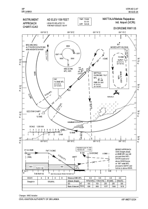
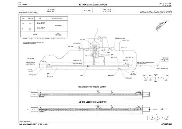


VCRI - Mattala Rajapaksa International Airport
Located in Hambantota, Sri Lanka
ICAO - VCRI, IATA - HRI
Data provided by AirmateGeneral information
Coordinates: N6°17'4" E81°7'27"
Elevation is 159 feet MSL.
View others Airports in Southern Province
Operational data
Special qualification required
Current time UTC:
Current local time:
Weather
TAF: TAF VCRI 091100Z 0912/1018 21007KT 9000 BKN018 FEW020CB TX36/1007Z TN26/1000Z PROB30 TEMPO 0912/0914 7000 -TSRA/SHRA BKN016 FEW018CB BECMG 0913/0915 VRB04KT
Communications frequencies: [VIEW]
Runways:
| RWY identifier | QFU | Length (ft) | Width (ft) | Surface | LDA (ft) |
| 05 | 46° | 11483 | 197 | Asphalt | |
| 23 | 226° | 11483 | 197 | Asphalt |
Airport contact information
Address: Hambantota Sri Lanka