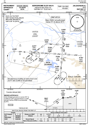
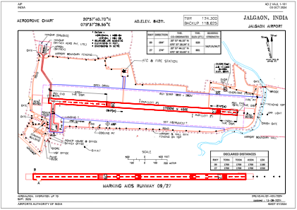


VAJL - Jalgaon Airport, Jalgaon
Located in Jalgaon, India
ICAO - , IATA -
Data provided by AirmateGeneral information
Coordinates: N20°57'41" E75°37'29"
Elevation is 842 feet MSL.
View others Airports in Maharashtra
Operational data
Special qualification required
Current time UTC:
Current local time:
Weather at : - ( 0 km )
METAR: KGBK 140205Z AUTO 16017KT 3SM BR OVC010 26/26 A2967 RMK A01
Communications frequencies: [VIEW]
Runways:
| RWY identifier | QFU | Length (ft) | Width (ft) | Surface | LDA (ft) |
| 09 | 94° | 5577 | 148 | UNK | |
| 27 | 274° | 5577 | 148 | UNK |
Airport contact information
Address: Jalgaon India