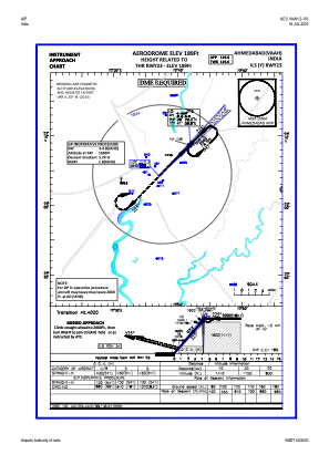
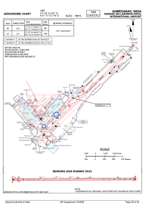


VAAH - Sardar Vallabh Bhai Patel International Airport, Ahmedabad
Located in Ahmedabad, India
ICAO - VAAH, IATA - AMD
Data provided by AirmateGeneral information
Coordinates: N23°4'16" E72°37'35"
Elevation is 189 feet MSL.
View others Airports in Gujarat
Operational data
Special qualification required
Current time UTC:
Current local time:
Weather
METAR: VAAH 211300Z 28004KT 6000 SCT020 43/11 Q1000 NOSIG
TAF: TAF VAAH 211100Z 2112/2121 29012KT 6000 FEW020 BECMG 2113/2115 31008KT 4000 FU NSC TEMPO 2114/2202 32010G20KT 4000 DRDU BECMG 2118/2120 29010KT
Communications frequencies: [VIEW]
Runways:
| RWY identifier | QFU | Length (ft) | Width (ft) | Surface | LDA (ft) |
| 05 | 45° | 11499 | 148 | PEM | |
| 23 | 225° | 11499 | 148 | PEM |
Airport contact information
Address: Ahmedabad India