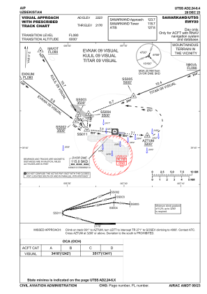
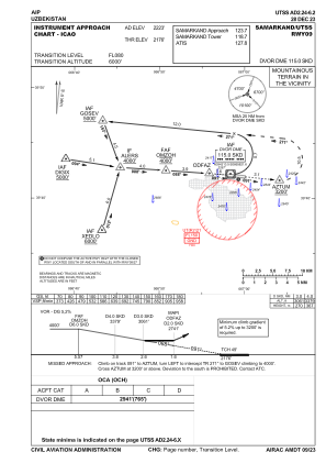
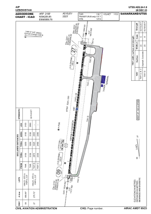


UTSS - Samarkand
Located in Samarkand, Uzbekistan
ICAO - UTSS, IATA - SKD
Data provided by AirmateGeneral information
Coordinates: N39°42'6" E66°58'57"
Elevation is 2223 feet MSL.
View others Airports in Samarqand
Operational data
Special qualification required
Current time UTC:
Current local time:
Weather
METAR: UTSS 141100Z 31006KT 270V010 9999 NSC 33/08 Q1010 R27/CLRD70 NOSIG
TAF: TAF UTSS 141100Z 1412/1512 20010G20KT 6000 FEW060CB BKN100 TEMPO 1412/1424 24020G30KT 2000 DS VV010 TEMPO 1500/1512 30016G26KT TS SCT060CB BKN100
Communications frequencies: [VIEW]
Runways:
| RWY identifier | QFU | Length (ft) | Width (ft) | Surface | LDA (ft) |
| 09 | 96° | 10187 | 148 | ASP | |
| 27 | 276° | 10187 | 148 | ASP |
Airport contact information
Address: Samarkand Uzbekistan