


UMKK - Kaliningrad/Khrabrovo
Located in Kaliningrad, Russian Federation
ICAO - UMKK, IATA - KGD
Data provided by AirmateGeneral information
Coordinates: N54°53'30" E20°35'55"
Elevation is 42 feet MSL.
View others Airports in Kaliningrad Oblast
Operational data
Special qualification required
Current time UTC:
Current local time:
Weather
METAR: UMKK 161500Z 14006MPS 110V170 CAVOK 20/03 Q1022 R06/95D NOSIG RMK QFE765/1020
TAF: TAF UMKK 161356Z 1615/1715 12006G12MPS CAVOK BECMG 1616/1618 11003G08MPS BECMG 1706/1708 10007G13MPS
Communications frequencies: [VIEW]
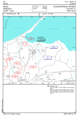
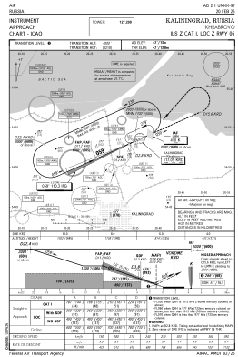
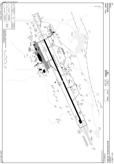
Runways:
| RWY identifier | QFU | Length (ft) | Width (ft) | Surface | LDA (ft) |
| 06 | 66° | 10991 | 148 | CON | |
| 24 | 246° | 10991 | 148 | CON |
Airport contact information
Address: Kaliningrad Russian Federation