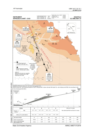
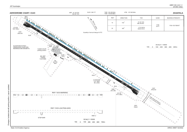


UBBY - Zagatala
Located in Zagatala, Azerbaijan
ICAO - UBBY, IATA - ZTU
Data provided by AirmateGeneral information
Coordinates: N41°33'30" E46°40'10"
Elevation is 1281 feet MSL.
Magnetic variation is 6° East View others Airports in Zaqatala
Operational data
Special qualification required
Current time UTC:
Current local time:
Weather
METAR: UBBY 271200Z 19006KT 9999 NSC 25/14 Q1023 NOSIG
TAF: TAF UBBY 271100Z 2712/2721 VRB04KT 9999 FEW100
Communications frequencies: [VIEW]
Runways:
| RWY identifier | QFU | Length (ft) | Width (ft) | Surface | LDA (ft) |
| 15 | 158° | 9843 | 148 | CONC+ASPH | 9843 |
| 33 | 338° | 9843 | 148 | CONC+ASPH | 9843 |
Airport contact information
Address: Zagatala Azerbaijan