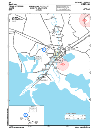
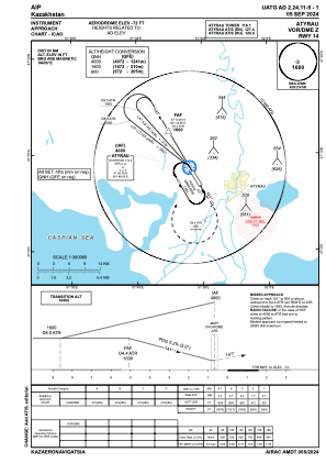
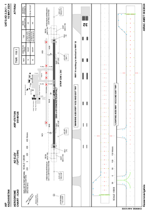


UATG - Atyrau
Located in Atyrau, Kazakhstan
ICAO - UATG, IATA - GUW
Data provided by AirmateGeneral information
Coordinates: N47°7'19" E51°49'12"
Elevation is -72 feet MSL.
Magnetic variation is 9° East View others Airports in Atyrau
Operational data
Special qualification required
Current time UTC:
Current local time:
Weather
METAR: UATG 101230Z 20006MPS 170V230 9999 SCT033CB 15/05 Q1021 NOSIG RMK QFE768/1024
TAF: TAF UATG 101100Z 1012/1112 19006MPS 9999 SCT033CB TX20/1110Z TN08/1102Z BECMG 1014/1016 VRB02MPS BECMG 1104/1106 13006MPS
Communications frequencies: [VIEW]
Runways:
| RWY identifier | QFU | Length (ft) | Width (ft) | Surface | LDA (ft) |
| 14 | 150° | 9839 | 148 | CONC+ASPH | 9839 |
| 32 | 330° | 9839 | 148 | CONC+ASPH | 9839 |
Airport contact information
Address: Atyrau Kazakhstan