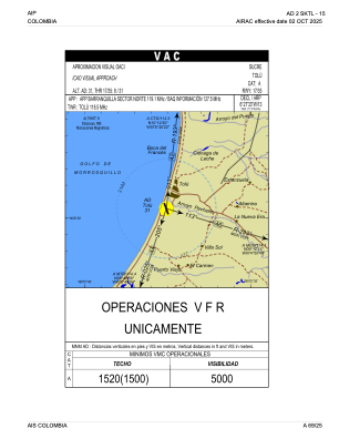


SKTL - Golfo De Morrosquillo
Located in Santiago de Tol, Colombia
ICAO - SKTL, IATA - TLU
Data provided by AirmateGeneral information
Coordinates: N9°30'34" W75°35'9"
Elevation is 31 feet MSL.
Magnetic variation is -8° East View others Airports in Sucre
Operational data
Special qualification required
Current time UTC:
Current local time:
Weather at : - ( 0 km )
METAR: CYPQ 171632Z AUTO 17007KT 120V190 2 1/2SM HZ CLR 19/14 A2990 RMK VIS VRB 1 1/4-3 SLP128 DENSITY ALT 1300FT
Communications frequencies: [VIEW]
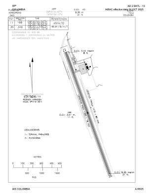
Runways:
| RWY identifier | QFU | Length (ft) | Width (ft) | Surface | LDA (ft) |
| 17 | 160° | 4430 | 52 | ASPH | 4430 |
| 35 | 340° | 4430 | 52 | ASPH | 4430 |
Airport contact information
Address: Santiago de Tol Colombia