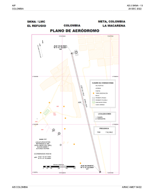


SKNA - La Macarena-El Refugio
Located in , Colombia
ICAO - , IATA - LMC
Data provided by AirmateGeneral information
Coordinates: N2°10'25" W73°47'10"
Elevation is 777 feet MSL.
Magnetic variation is -8° East View others Airports in Meta
Operational data
Special qualification required
Current time UTC:
Current local time:
Weather at : - ( 0 km )
METAR: KASG 171848Z 04004KT 10SM FEW043 FEW095 25/20 A2981
Communications frequencies: [VIEW]
Runways:
| RWY identifier | QFU | Length (ft) | Width (ft) | Surface | LDA (ft) |
| 17 | 167° | 5187 | 54 | PAVE | 5187 |
| 35 | 347° | 5187 | 54 | PAVE | 5187 |
Airport contact information
Address: Colombia