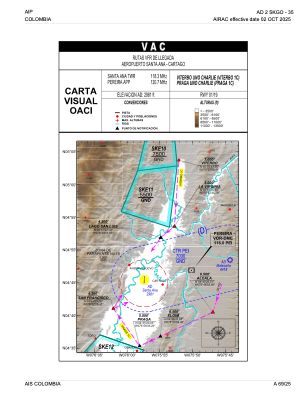
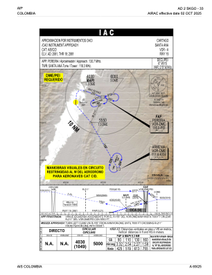
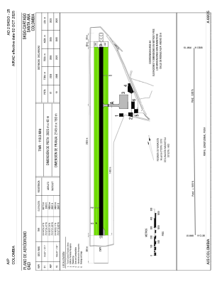


SKGO - Cartago-Santa Ana
Located in Cartago, Colombia
ICAO - SKGO, IATA - CRC
Data provided by AirmateGeneral information
Coordinates: N4°45'27" W75°57'22"
Elevation is 2981 feet MSL.
Magnetic variation is -7° East View others Airports in Valle del Cauca
Operational data
Special qualification required
Current time UTC:
Current local time:
Weather at : SKPE - Pereira-Matecana ( 25 km )
METAR: SKPE 220300Z VRB02KT 9999 SCT020 SCT080 23/19 Q1018
TAF: TAF SKPE 212230Z 2200/2224 10005KT 9999 FEW020 SCT090 TEMPO 2222/2224 31010KT DZ SCT020TCU BKN080 TX28/2220Z TN21/2210Z
Communications frequencies: [VIEW]
Runways:
| RWY identifier | QFU | Length (ft) | Width (ft) | Surface | LDA (ft) |
| 01 | 5° | 6644 | 131 | ASPH | 6644 |
| 19 | 185° | 6644 | 131 | ASPH | 6644 |
Airport contact information
Address: Cartago Colombia