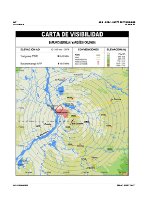
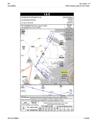


SKEJ - Yariguies
Located in Barrancabermeja, Colombia
ICAO - SKEJ, IATA - EJA
Data provided by AirmateGeneral information
Coordinates: N7°1'26" W73°48'26"
Elevation is 414 feet MSL.
Magnetic variation is -8° East View others Airports in Santander
Operational data
Special qualification required
Current time UTC:
Current local time:
Weather at : SKBG - Palonegro ( 70 km )
METAR: SKBG 171900Z 34005KT 9999 SCT017 SCT080 27/22 Q1014
TAF: TAF SKBG 171630Z 1718/1818 32010KT 9999 SCT017 TEMPO 1721/1724 DZRA SCT015TCU BECMG 1800/1802 VRB02KT SCT010 TX27/1719Z TN19/1810Z
Communications frequencies: [VIEW]
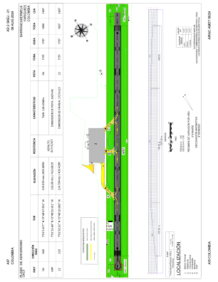
Runways:
| RWY identifier | QFU | Length (ft) | Width (ft) | Surface | LDA (ft) |
| 04 | 31° | 5906 | 148 | ASPH | 5906 |
| 22 | 211° | 5906 | 148 | ASPH | 5906 |
Airport contact information
Address: Barrancabermeja Colombia