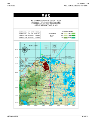
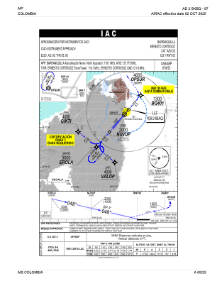
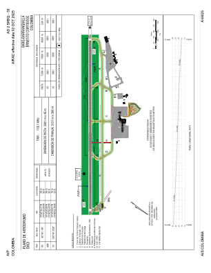


SKBQ - Barranquilla-Ernesto Cortissoz
Located in Barranquilla, Colombia
ICAO - SKBQ, IATA - BAQ
Data provided by AirmateGeneral information
Coordinates: N10°53'22" W74°46'50"
Elevation is 95 feet MSL.
Magnetic variation is -8° East View others Airports in Atlántico
Operational data
Special qualification required
Current time UTC:
Current local time:
Weather
METAR: SKBQ 210200Z VRB02KT 9999 FEW015 27/24 Q1008 NOSIG
TAF: TAF SKBQ 202230Z 2100/2124 02010KT 9999 FEW015 BECMG 2106/2108 VRB02KT TEMPO 2110/2112 5000 BR BKN010 BECMG 2118/2120 02010KT PROB40 2119/2121 DZ FEW010CB TX33/2118Z TN27/2110Z
Communications frequencies: [VIEW]
Runways:
| RWY identifier | QFU | Length (ft) | Width (ft) | Surface | LDA (ft) |
| 05 | 41° | 9846 | 148 | ASPH | 9846 |
| 23 | 221° | 9846 | 148 | ASPH | 9846 |
Airport contact information
Address: Barranquilla Colombia

