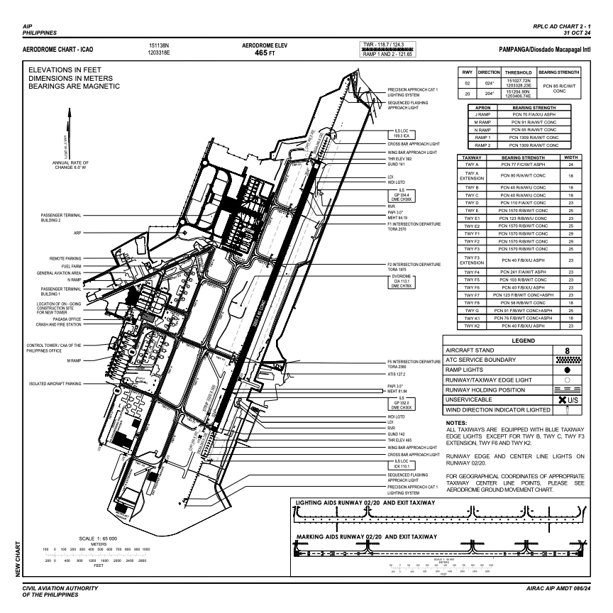


RPLC - Diosdado Macapagal International Airport
Located in Angeles City, Philippines
ICAO - RPLC, IATA - CRK
Data provided by AirmateGeneral information
Coordinates: N15°11'10" E120°33'37"
Elevation is 484 feet MSL.
Magnetic variation is -3° East View others Airports in Pampanga
Operational data
Special qualification required
Current time UTC:
Current local time:
Weather
METAR: RPLC 120700Z 04004KT 9999 SCT020 37/22 Q1009 NOSIG RMK A2980
TAF: TAF RPLC 120500Z 1206/1312 34008KT 9999 SCT020 TX35/1206Z TN26/1221Z TEMPO 1206/1212 18010KT 6000 -TSRA FEW015CB SCT020 BKN100
Communications frequencies: [VIEW]
Runways:
| RWY identifier | QFU | Length (ft) | Width (ft) | Surface | LDA (ft) |
| 02 | 21° | 10499 | 197 | CONC | 10499 |
| 20 | 201° | 10499 | 197 | CONC | 10499 |
Airport contact information
Address: Angeles City Philippines