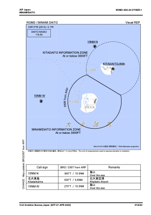
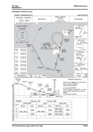
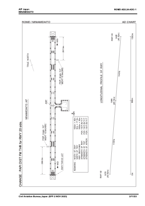


ROMD - Minamidaito
Located in , Japan
ICAO - ROMD, IATA - MMD
Data provided by AirmateGeneral information
Coordinates: N25°50'48" E131°15'49"
Elevation is 158 feet MSL.
View others Airports in Okinawa Prefecture
Operational data
Special qualification required
Current time UTC:
Current local time:
Weather
METAR: ROMD 200010Z AUTO 02008KT 360V060 9999 BKN008 BKN010 OVC016 24/22 Q1013 RMK A2992
Communications frequencies: [VIEW]
Runways:
| RWY identifier | QFU | Length (ft) | Width (ft) | Surface | LDA (ft) |
| 02 | 16° | 4921 | 148 | ASP | |
| 20 | 196° | 4921 | 148 | ASP |
Airport contact information
Address: Japan