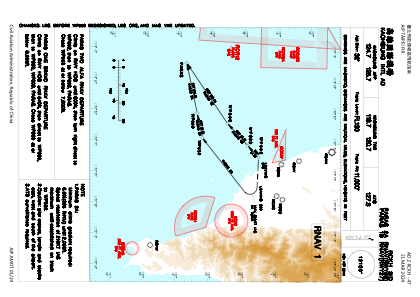
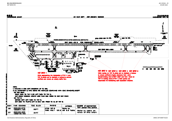


RCKH - Kaohsiung Intl
Located in Kaohsiung, Taiwan, Province of China
ICAO - RCKH, IATA - KHH
Data provided by AirmateGeneral information
Coordinates: N22°34'37" E120°21'1"
Elevation is 31 feet MSL.
View others Airports in Kaohsiung (municipality)
Operational data
Special qualification required
Current time UTC:
Current local time:
Weather
METAR: RCKH 160130Z VRB03KT 9999 FEW020 SCT120 BKN200 31/21 Q1013 NOSIG RMK A2994
TAF: TAF RCKH 152300Z 1600/1706 27005KT 9999 FEW015 BKN032 TEMPO 1603/1609 24010KT FEW012 BKN020 TEMPO 1618/1624 06005KT FEW012 BKN020 TEMPO 1703/1706 30010KT
Communications frequencies: [VIEW]
Runways:
| RWY identifier | QFU | Length (ft) | Width (ft) | Surface | LDA (ft) |
| 09 | 92° | 10335 | 197 | CON | |
| 27 | 272° | 10335 | 197 | CON |
Airport contact information
Address: Kaohsiung Taiwan, Province of China