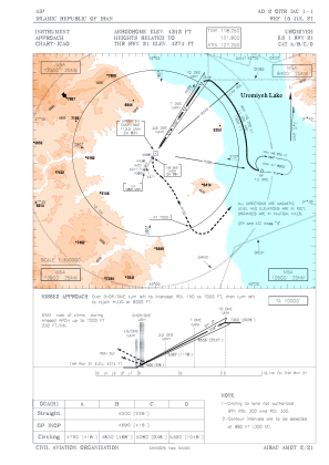
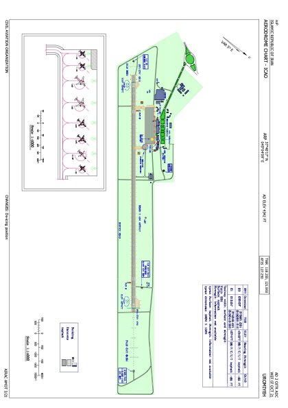


OITR - Uromiyeh
Located in Uromiyeh, Iran, Islamic Republic of
ICAO - OITR, IATA - OMH
Data provided by AirmateGeneral information
Coordinates: N37°40'17" E45°4'9"
Elevation is 4342 feet MSL.
View others Airports in West Azarbaijan Province
Operational data
Special qualification required
Current time UTC:
Current local time:
Weather
METAR: OITR 160500Z 26008KT 9999 FEW035CB SCT040 17/03 Q1018 A3008 NOSIG
TAF: TAF OITR 152300Z 1600/1706 27007KT 8000 FEW040 TEMPO 1608/1615 23017KT FEW035CB SCT040 TEMPO 1700/1706 35018KT SHRA SCT030CB SCT035 BKN090
Communications frequencies: [VIEW]
Runways:
| RWY identifier | QFU | Length (ft) | Width (ft) | Surface | LDA (ft) |
| 03 | 33° | 10669 | 148 | ASP | |
| 21 | 213° | 10669 | 148 | ASP |
Airport contact information
Address: Uromiyeh Iran, Islamic Republic of