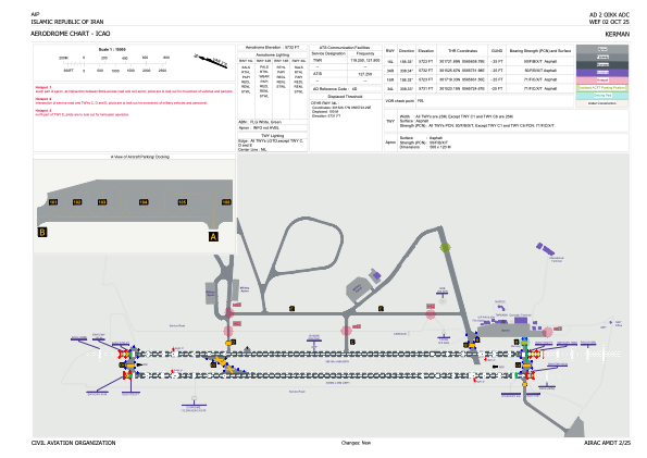


OIKK - Kerman
Located in Kerman, Iran, Islamic Republic of
ICAO - OIKK, IATA - KER
Data provided by AirmateGeneral information
Coordinates: N30°16'28" E56°57'4"
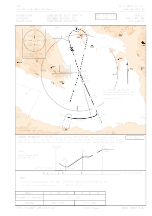
Elevation is 5732 feet MSL.
View others Airports in Kerman Province
Operational data
Special qualification required
Current time UTC:
Current local time:
Weather
METAR: OIKK 160530Z 22010KT 9999 FEW035TCU FEW040 BKN100 22/08 Q1026 A3030
TAF: TAF OIKK 152300Z 1600/1706 16004KT 9999 FEW100 TEMPO 1609/1616 27018G28KT 4000 TS SA FEW035CB BKN040 TEMPO 1702/1706 26012KT
Communications frequencies: [VIEW]
Runways:
| RWY identifier | QFU | Length (ft) | Width (ft) | Surface | LDA (ft) |
| 16L | 158° | 12635 | 148 | UNK | |
| 34R | 338° | 12635 | 148 | UNK | |
| 16R | 158° | 12631 | 148 | UNK | |
| 34L | 338° | 12631 | 148 | UNK |
Airport contact information
Address: Kerman Iran, Islamic Republic of