


OENG - Nejran
Located in Nejran, Saudi Arabia
ICAO - OENG, IATA - EAM
Data provided by AirmateGeneral information
Coordinates: N17°36'41" E44°25'9"
Elevation is 3983 feet MSL.
View others Airports in Najran
Operational data
Special qualification required
Current time UTC:
Current local time:
Weather
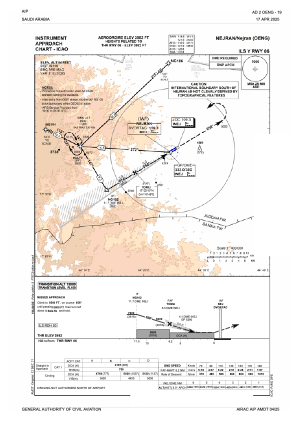
TAF: TAF OENG 191100Z 1912/2018 07014KT 9999 SCT030 TEMPO 1912/1920 4000 BLDU BECMG 1920/1922 VRB03KT BECMG 2008/2010 08010KT
Communications frequencies: [VIEW]
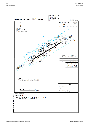
Runways:
| RWY identifier | QFU | Length (ft) | Width (ft) | Surface | LDA (ft) |
| 06 | 60° | 10007 | 148 | ASP | |
| 24 | 240° | 10007 | 148 | ASP |
Airport contact information
Address: Nejran Saudi Arabia