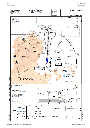
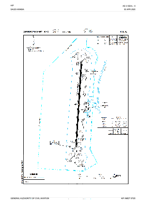


OEHL - Hail
Located in Hail, Saudi Arabia
ICAO - OEHL, IATA - HAS
Data provided by AirmateGeneral information
Coordinates: N27°26'23" E41°41'11"
Elevation is 3305 feet MSL.
View others Airports in Ha'il
Operational data
Special qualification required
Current time UTC:
Current local time:
Weather
METAR: OEHL 191200Z 24006KT CAVOK 36/03 Q1014
TAF: TAF OEHL 191100Z 1912/2018 29010KT CAVOK BECMG 1922/2000 VRB03KT BECMG 2008/2010 30014KT 7000 NSC
Communications frequencies: [VIEW]
Runways:
| RWY identifier | QFU | Length (ft) | Width (ft) | Surface | LDA (ft) |
| 18 | 184° | 10827 | 148 | ASP | |
| 36 | 4° | 10827 | 148 | ASP |
Airport contact information
Address: Hail Saudi Arabia