
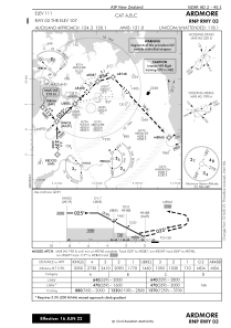


NZAR - Ardmore
Located in Auckland, New Zealand
ICAO - NZAR, IATA - AMZ
Data provided by AirmateGeneral information
Coordinates: S37°1'47" E174°58'24"
Elevation is 111 feet MSL.
Magnetic variation is +20° East View others Airports in Auckland Region
Operational data
Special qualification required
Current time UTC:
Current local time:
Weather at : NZAA - Auckland ( 16 km )
TAF: TAF NZAA 192017Z 1921/2100 18005KT 9999 SCT030 BECMG 1921/1923 09012KT FM200900 06015G25KT 6000 RA BKN020 TEMPO 2009/2012 3000 +RA BKN012 TEMPO 2012/2022 3000 +RA BKN007 BECMG 2017/2019 03010KT 9999 -SHRA BECMG 2022/2100 33010KT
Communications frequencies: [VIEW]
Runways:
| RWY identifier | QFU | Length (ft) | Width (ft) | Surface | LDA (ft) |
| 03 | 45° | 1699 | 59 | GRASS | 4285 |
| 21 | 225° | 4629 | 148 | BITUM | 4262 |
| 07 | 90° | 1959 | 59 | GRASS | 1959 |
| 25 | 270° | 1959 | 59 | GRASS | 1959 |
| 21 GR | 0° | 1699 | 59 | GRASS | |
| 03G | 45° | 0 | 0 | UNK | 1699 |
| 21G | 225° | 0 | 0 | UNK | 1699 |
Airport contact information
Address: Auckland New Zealand
Other aviation service providers
Flight schools

Heliflite Charter & Training Limited
Heliflite Charter & Training Limited
Sylvia@HeliflitePacific.com+6492999103

