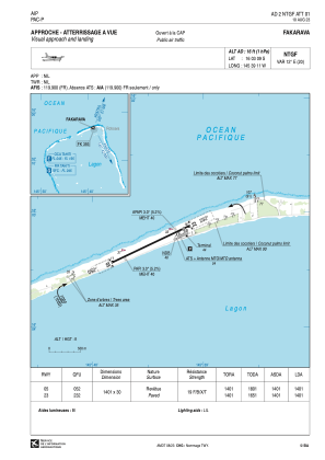
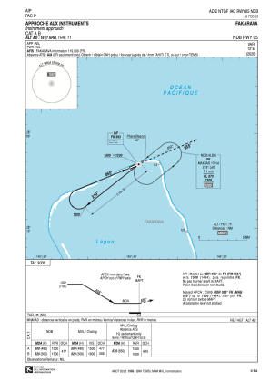
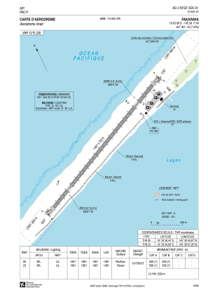


NTGF - Fakarava
Located in Rotoava, French Polynesia
ICAO - NTGF, IATA - FAV
Data provided by AirmateGeneral information
Coordinates: S16°3'9" W145°39'11"
Elevation is 16 feet MSL.
Magnetic variation is 12.49° East View others Airports in (unassigned)
Operational data
Special qualification required
Current time UTC:
Current local time:
Weather at : - ( 0 km )
METAR: CYXS 150121Z AUTO 23009G15KT 9SM BKN060 OVC078 15/05 A3000 RMK SLP167 DENSITY ALT 2700FT
Communications frequencies: [VIEW]
Runways:
| RWY identifier | QFU | Length (ft) | Width (ft) | Surface | LDA (ft) |
| 05 | 65° | 4596 | 98 | ASPH | 4596 |
| 23 | 245° | 4596 | 98 | ASPH | 4596 |
Airport contact information
Address: Rotoava French Polynesia