


NE95 - Frenchman
Located in Culbertson, United States
ICAO - NE95, IATA -
Data provided by AirmateGeneral information
Coordinates: N40°13'46" W100°51'25"
Elevation is 2590 feet MSL.
View others Airports in Nebraska
Operational data
Special qualification required
Current time UTC:
Current local time:
Weather at : KMCK - Mc Cook Ben Nelson Rgnl ( 23 km )
METAR: KMCK 080353Z AUTO 31007KT 10SM BKN110 18/M03 A2958 RMK AO2 SLP001 T01781033
TAF: KMCK 072320Z 0800/0824 27015G26KT P6SM BKN120 FM080100 27011KT P6SM BKN120 FM081400 30016G26KT P6SM SKC
Communications frequencies: [VIEW]
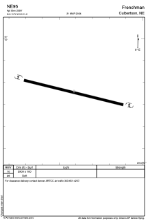
Runways:
| RWY identifier | QFU | Length (ft) | Width (ft) | Surface | LDA (ft) |
| 10 | 0° | 2900 | 100 | GRASS | |
| 28 | 0° | 2900 | 100 | GRASS |
Airport contact information
Address: Culbertson United States