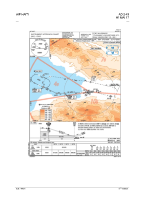
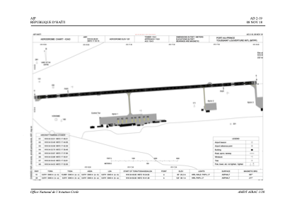


MTPP - Port-Au-Prince/International
Located in Port Au Prince, Haiti
ICAO - MTPP, IATA - PAP
Data provided by AirmateGeneral information
Coordinates: N18°34'48" W72°17'33"
Elevation is 122 feet MSL.
View others Airports in Ouest Department
Operational data
Special qualification required
Current time UTC:
Current local time:
Weather
METAR: MTPP 131300Z 11008KT 8000 FEW024 ///// Q1014 A2996
TAF: TAF MTPP 131042Z 1312/1412 VRB02KT 8000 FEW018 BECMG 1314/1317 12010KT SCT026 FM131800 28012KT 9999 SCT028 PROB30 TEMPO 1400/1406 08010KT 4800 TSRA SCT018CB BKN040 FM140700 11007KT 7000 FEW018
Communications frequencies: [VIEW]
Runways:
| RWY identifier | QFU | Length (ft) | Width (ft) | Surface | LDA (ft) |
| 10 | 87° | 10039 | 148 | ASP | |
| 28 | 267° | 10039 | 148 | ASP |
Airport contact information
Address: Port Au Prince Haiti