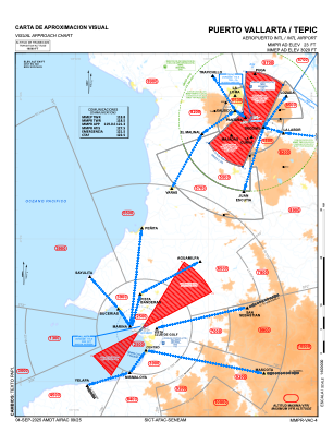
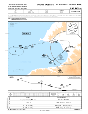
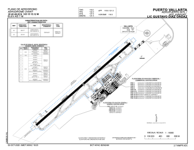


MMPR - Puerto Vallarta Aeropuerto Int. Lic. Gustavo Diaz Ordaz
Located in Puerto Vallarta, Mexico
ICAO - MMPR, IATA - PVR
Data provided by AirmateGeneral information
Coordinates: N20°40'48" W105°15'15"
Elevation is 23 feet MSL.
View others Airports in Jalisco
Operational data
Special qualification required
Current time UTC:
Current local time:
Weather
METAR: MMPR 162041Z 21011KT 12SM SKC 28/22 A2981 RMK SLP093 57019 905 HZY
TAF: TAF MMPR 161708Z 1618/1718 20015KT P6SM SKC TX30/1618Z TN20/1712Z FM170300 34005KT P6SM SKC
Communications frequencies: [VIEW]
Runways:
| RWY identifier | QFU | Length (ft) | Width (ft) | Surface | LDA (ft) |
| 04 | 47° | 10187 | 148 | ASP | |
| 22 | 227° | 10187 | 148 | ASP |
Airport contact information
Address: Puerto Vallarta Mexico