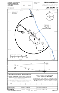
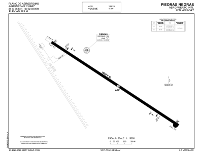


MMPG - Piedras Negras Aeropuerto Internacional
Located in Piedras Negras, Mexico
ICAO - MMPG, IATA - PDS
Data provided by AirmateGeneral information
Coordinates: N28°37'39" W100°32'4"
Elevation is 901 feet MSL.
View others Airports in Coahuila
Operational data
Special qualification required
Current time UTC:
Current local time:
Weather
METAR: MMPG 171341Z 00000KT 10SM FEW120 SCT200 22/18 A2983 RMK 8/071
TAF: TAF AMD MMPG 171334Z 1714/1806 03005KT P6SM SCT100 SCT200 FM171800 03010KT P6SM SCT030 SCT200 FM180200 13005KT 6SM HZ SCT200
Communications frequencies: [VIEW]
Runways:
| RWY identifier | QFU | Length (ft) | Width (ft) | Surface | LDA (ft) |
| 12 | 127° | 6726 | 105 | ASP | |
| 30 | 307° | 6726 | 105 | ASP |
Airport contact information
Address: Piedras Negras Mexico