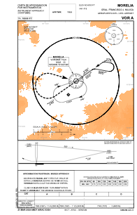
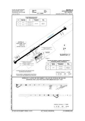


MMMM - Morelia Aeropuerto Internacional Gral. Francisco J. Mujica
Located in Morelia, Mexico
ICAO - MMMM, IATA - MLM
Data provided by AirmateGeneral information
Coordinates: N19°50'60" W101°1'31"
Elevation is 6033 feet MSL.
View others Airports in Michoacin
Operational data
Special qualification required
Current time UTC:
Current local time:
Weather
METAR: MMMM 161149Z 00000KT 6SM SKC 14/06 A3016 RMK SLP049 57004 904 HZY
TAF: TAF MMMM 161116Z 1612/1712 23005KT 6SM HZ SKC TEMPO 1614/1618 4SM HZ FM161800 18010KT P6SM SCT030 SCT280 FM170000 18005KT P6SM SCT030 SCT280 FM170600 24005KT 6SM SKC
Communications frequencies: [VIEW]
Runways:
| RWY identifier | QFU | Length (ft) | Width (ft) | Surface | LDA (ft) |
| 05 | 54° | 11181 | 148 | ASP | |
| 23 | 234° | 11181 | 148 | ASP |
Airport contact information
Address: Morelia Mexico