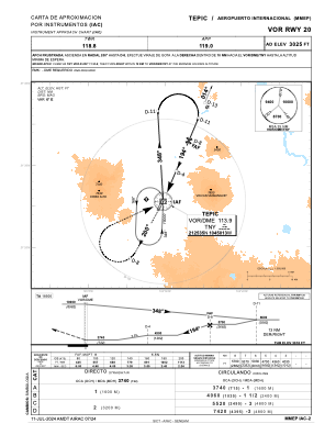
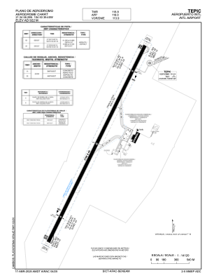


MMEP - Tepic Aeropuerto Internacional
Located in Tepic, Mexico
ICAO - MMEP, IATA - TPQ
Data provided by AirmateGeneral information
Coordinates: N21°24'58" W104°50'39"
Elevation is 3020 feet MSL.
View others Airports in Nayarit
Operational data
Special qualification required
Current time UTC:
Current local time:
Weather
TAF: TAF MMEP 160506Z 1606/1706 00000KT P6SM SKC FM161800 36010KT P6SM SKC BECMG 1701/1702 00000KT
Communications frequencies: [VIEW]
Runways:
| RWY identifier | QFU | Length (ft) | Width (ft) | Surface | LDA (ft) |
| 02 | 26° | 10190 | 148 | ASP | |
| 20 | 206° | 10190 | 148 | ASP |
Airport contact information
Address: Tepic Mexico