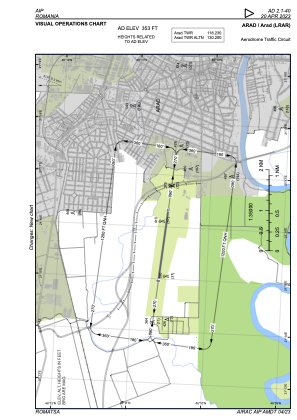
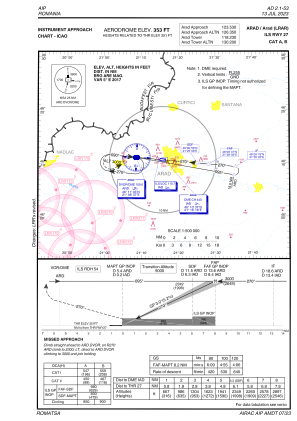
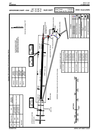


LRAR - Arad
Located in Arad, Romania
ICAO - LRAR, IATA - ARW
Data provided by AirmateGeneral information
Coordinates: N46°10'36" E21°15'43"
Elevation is 353 feet MSL.
Magnetic variation is 5° East View others Airports in Arad
Operational data
Special qualification required
Current time UTC:
Current local time:
Weather
METAR: LRAR 221630Z 21006KT 9999 SCT043CB 23/16 Q1010
TAF: TAF LRAR 221400Z 2215/2300 16006KT 9999 SCT040CB TEMPO 2215/2218 5000 -TSRA TEMPO 2220/2300 5000 -SHRA
Communications frequencies: [VIEW]
Runways:
| RWY identifier | QFU | Length (ft) | Width (ft) | Surface | LDA (ft) |
| 09 | 95° | 6562 | 148 | CONC | 5971 |
| 27 | 275° | 6562 | 148 | CONC | 5971 |
Airport contact information
Address: Arad Romania