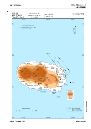
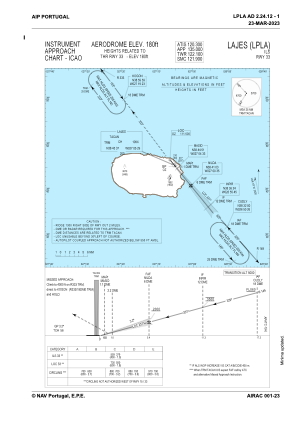
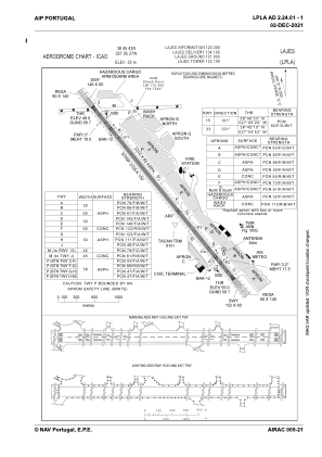


LPLA - Lajes
Located in Angra Do Heroismo, Portugal
ICAO - LPLA, IATA - TER
Data provided by AirmateGeneral information
Coordinates: N38°45'43" W27°5'27"
Elevation is 180 feet MSL.
Magnetic variation is -009.9100° East View others Airports in Autonomous Region of Azores
Operational data
Special qualification required
Current time UTC:
Current local time:
Weather
METAR: LPLA 180800Z /////KT 9999 BKN040 16/09 Q1025
TAF: TAF LPLA 180504Z 1806/1906 01008KT 9999 FEW020 BKN035 PROB30 TEMPO 1811/1818 7000 -SHRA BKN018
Communications frequencies: [VIEW]
Runways:
| RWY identifier | QFU | Length (ft) | Width (ft) | Surface | LDA (ft) |
| 15 | 141° | 10860 | 197 | ASP | |
| 33 | 321° | 10860 | 197 | ASP |
Airport contact information
Address: Angra Do Heroismo Portugal
