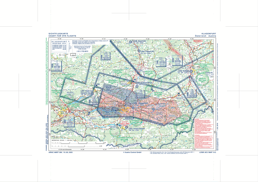
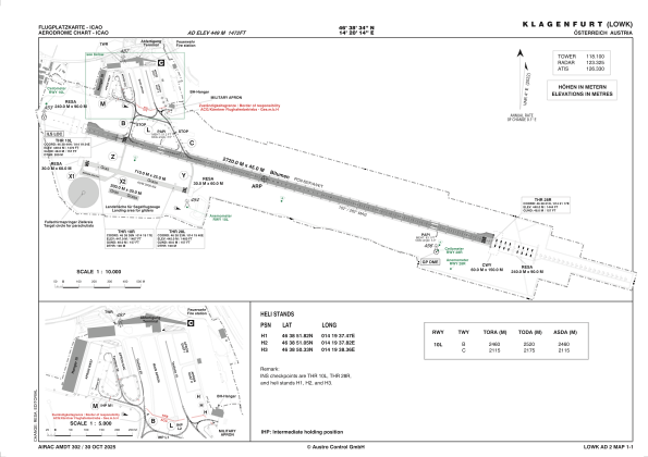


LOWK - Klagenfurt
Located in Klagenfurt, Austria
ICAO - LOWK, IATA - KLU
Data provided by AirmateGeneral information
Coordinates: N46°38'34" E14°20'14"
Elevation is 1472 feet MSL.
View others Airports in Carinthia
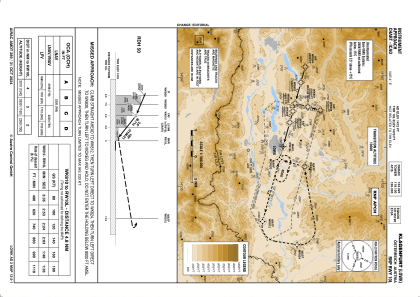
Operational data
Special qualification required
Current time UTC:
Current local time:
Weather
METAR: LOWK 150520Z AUTO VRB01KT 9999 NCD 11/08 Q1014 NOSIG
TAF: TAF LOWK 150515Z 1506/1606 VRB05KT 9999 BKN030 TX19/1513Z TN12/1506Z BECMG 1514/1516 -RA TEMPO 1516/1606 10007KT 3000 SHRA
Communications frequencies: [VIEW]
Runways:
| RWY identifier | QFU | Length (ft) | Width (ft) | Surface | LDA (ft) |
| 10R | 106° | 2427 | 90 | GRS | |
| 28L | 286° | 2427 | 90 | GRS | |
| 10L | 106° | 8924 | 148 | CON | |
| 28R | 286° | 8924 | 148 | CON |
Airport contact information
Address: Klagenfurt Austria
