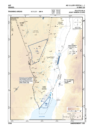
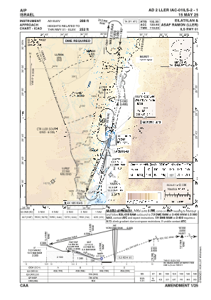
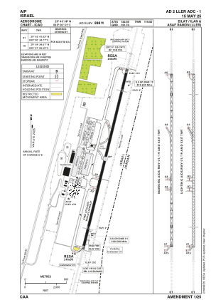


LLER - Eilat/ Ilan And Asaf Ramon
Located in Eilat, Israel
ICAO - , IATA -
Data provided by AirmateGeneral information
Coordinates: N29°43'38" E35°0'51"
Elevation is 288 feet MSL.
Magnetic variation is 5° East View others Airports in South District
Operational data
Special qualification required
Current time UTC:
Current local time:
Weather
METAR: LLER 151950Z 32014KT CAVOK 24/06 Q1016
TAF: TAF LLER 151703Z 1518/1618 01015KT CAVOK TEMPO 1518/1519 32020G30KT PROB40 TEMPO 1519/1607 35008KT TEMPO 1607/1618 02020G30KT TX33/1612Z TN18/1603Z
Communications frequencies: [VIEW]
Runways:
| RWY identifier | QFU | Length (ft) | Width (ft) | Surface | LDA (ft) |
| 01 | 14° | 11811 | 148 | ASPH | 11811 |
| 19 | 194° | 11811 | 148 | ASPH | 11811 |
Airport contact information
Address: Eilat Israel