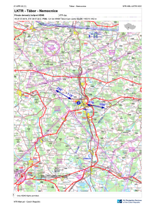
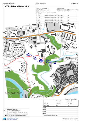


LKTR - Tabor - Nemocnice
Located in Tabor, Czech Republic
ICAO - , IATA -
Data provided by AirmateGeneral information
Coordinates: N49°24'57" E14°39'8"
Elevation is 1450 feet MSL.
View others Airports in South Bohemian Region
Operational data
Special qualification required
Current time UTC:
Current local time:
Weather at : LKCV - Caslav ( 78 km )
METAR: LKCV 131100Z 12005KT 080V160 CAVOK 20/06 Q1017 NOSIG RMK BLU BLU
TAF: TAF LKCV 130500Z 1306/1406 12005KT CAVOK BECMG 1307/1309 12009KT TEMPO 1309/1318 15015KT SCT035 BECMG 1321/1323 14004KT
Communications frequencies: [VIEW]
Runways:
Airport contact information
Address: Tabor Czech Republic