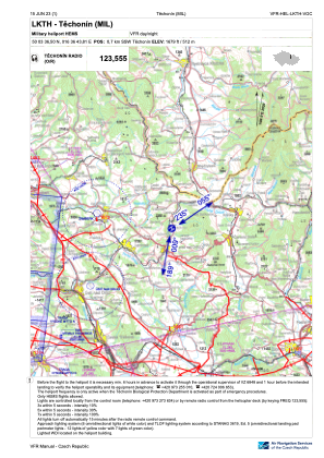
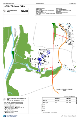


LKTH - Techonin
Located in Techonin, Czech Republic
ICAO - , IATA -
Data provided by AirmateGeneral information
Coordinates: N50°3'37" E16°36'44"
Elevation is 1679 feet MSL.
View others Airports in Pardubice Region
Operational data
Special qualification required
Current time UTC:
Current local time:
Weather at : LKPD - Pardubice ( 63 km )
METAR: LKPD 131730Z 13007KT CAVOK 20/08 Q1014 NOSIG RMK BLU BLU
TAF: TAF LKPD 131100Z 1312/1412 12008KT CAVOK
Communications frequencies: [VIEW]
Runways:
Airport contact information
Address: Techonin Czech Republic