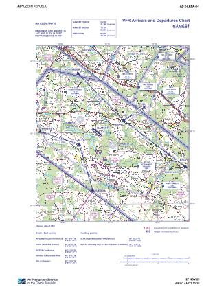
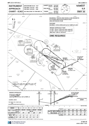
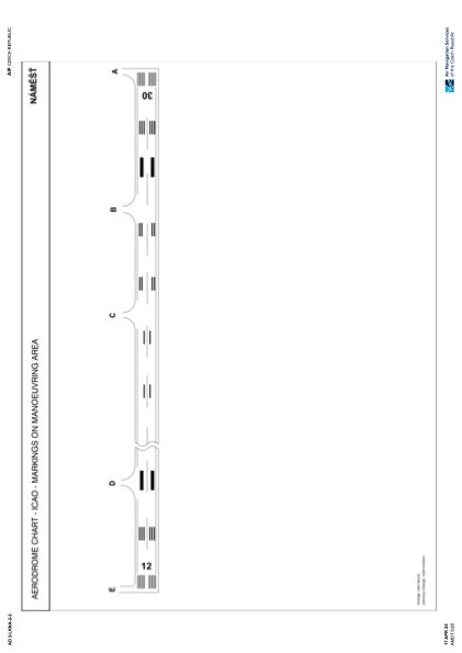


LKNA - Namest
Located in Namest, Czech Republic
ICAO - LKNA, IATA -
Data provided by AirmateGeneral information
Coordinates: N49°9'58" E16°7'28"
Elevation is 1547 feet MSL.
Magnetic variation is 5° East View others Airports in Vysocina Region
Operational data
Special qualification required
Current time UTC:
Current local time:
Weather
METAR: LKNA 110800Z 30005KT 270V330 CAVOK 17/06 Q1022 RMK BLACK
TAF: TAF LKNA 110500Z 1106/1206 33006KT CAVOK TEMPO 1109/1206 03005KT 9999 BKN045 PROB40 TEMPO 1110/1118 9999 SHRA BKN035TCU
Communications frequencies: [VIEW]
Runways:
| RWY identifier | QFU | Length (ft) | Width (ft) | Surface | LDA (ft) |
| 12 | 0° | 7874 | 148 | UNK | |
| 30 | 0° | 7874 | 148 | UNK |
Airport contact information
Address: Namest Czech Republic