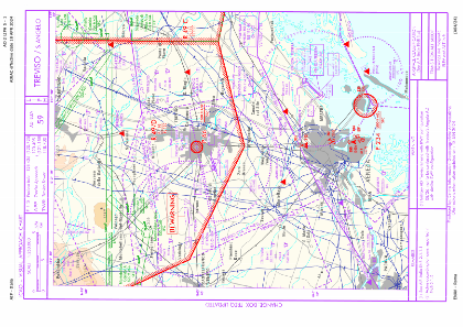
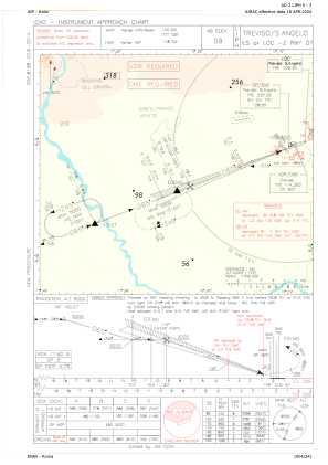
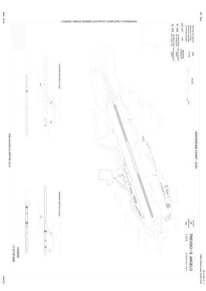


LIPH - Treviso/S.Angelo
Located in Treviso, Italy
ICAO - LIPH, IATA - TSF
Data provided by AirmateGeneral information
Coordinates: N45°39'3" E12°11'52"
Elevation is 59 feet MSL.
View others Airports in Veneto
Operational data
Special qualification required
Current time UTC:
Current local time:
Weather
METAR: LIPH 161820Z 08008KT 030V110 7000 -TSRA FEW005 FEW012CB BKN020 15/15 Q1003
TAF: TAF LIPH 161700Z 1618/1718 05013KT 9999 BKN020 TEMPO 1618/1621 4000 TSRA BECMG 1618/1620 VRB05KT PROB40 TEMPO 1623/1705 3000 BR BECMG 1710/1712 23010KT
Communications frequencies: [VIEW]
Runways:
| RWY identifier | QFU | Length (ft) | Width (ft) | Surface | LDA (ft) |
| 07 | 69° | 7940 | 148 | ASP | |
| 25 | 249° | 7940 | 148 | ASP |
Airport contact information
Address: Treviso Italy
