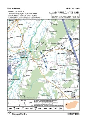
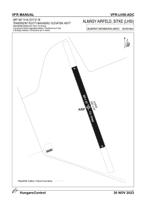


LHSI - Almasy Airfield
Located in Sitke, Hungary
ICAO - , IATA -
Data provided by AirmateGeneral information
Coordinates: N47°14'4" E17°1'38"
Elevation is 459 feet MSL.
View others Airports in Vas
Operational data
Special qualification required
Current time UTC:
Current local time:
Weather at : LHPA - Papa ( 38 km )
METAR: LHPA 111015Z VRB03KT 9999 FEW050TCU 21/08 Q1020 NOSIG RMK BLU
TAF: TAF LHPA 110515Z 1106/1206 VRB03KT CAVOK BECMG 1106/1108 01006KT PROB30 TEMPO 1110/1116 9999 SCT060TCU BKN200 BECMG 1120/1123 VRB03KT
Communications frequencies: [VIEW]
Runways:
| RWY identifier | QFU | Length (ft) | Width (ft) | Surface | LDA (ft) |
| 16 | 0° | 1050 | 66 | GRASS | |
| 34 | 0° | 1050 | 66 | GRASS |
Airport contact information
Address: Sitke Hungary