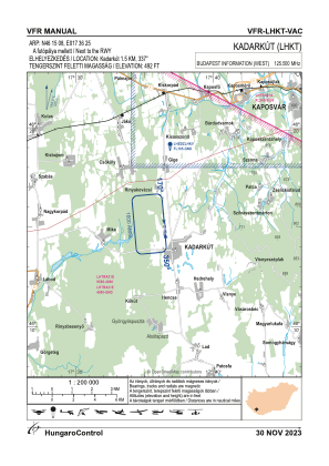
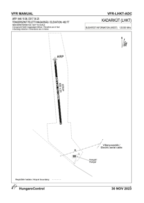


LHKT - Kadarkut
Located in Kadarkut, Hungary
ICAO - , IATA -
Data provided by AirmateGeneral information
Coordinates: N46°15'8" E17°36'25"
Elevation is 492 feet MSL.
View others Airports in Somogy
Operational data
Special qualification required
Current time UTC:
Current local time:
Weather at : LHPP - Pecs/Pogany ( 57 km )
METAR: LHPP 171645Z AUTO 16003KT 130V220 9999 SCT070 //////TCU 23/11 Q1011
TAF: TAF LHPP 171415Z 1715/1724 24008KT CAVOK
Communications frequencies: [VIEW]
Runways:
| RWY identifier | QFU | Length (ft) | Width (ft) | Surface | LDA (ft) |
| 17 | 0° | 2625 | 66 | GRASS | |
| 35 | 0° | 2625 | 66 | GRASS |
Airport contact information
Address: Kadarkut Hungary