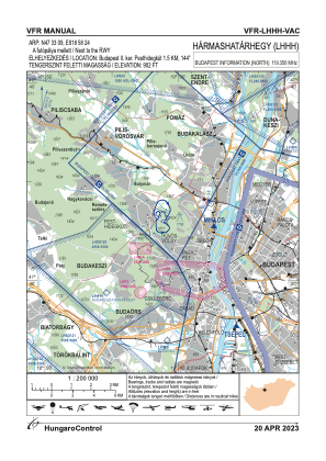
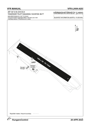


LHHH - Harmashatarhegy
Located in Budapest, Hungary
ICAO - LHHH, IATA -
Data provided by AirmateGeneral information
Coordinates: N47°33'1" E18°58'24"
Elevation is 902 feet MSL.
Magnetic variation is 5° East View others Airports in Budapest
Operational data
Special qualification required
Current time UTC:
Current local time:
Weather at : LHBP - Budapest/Liszt Ferenc International Airport ( 25 km )
TAF: TAF LHBP 201715Z 2018/2118 08007KT CAVOK TEMPO 2018/2022 VRB18G30KT 2500 SHRA TSRA BKN030CB TEMPO 2022/2104 VRB02KT MIFG PROB30 TEMPO 2022/2104 1500 BCFG BR BECMG 2105/2108 11012G22KT TEMPO 2108/2112 SCT045 BKN140
Communications frequencies: [VIEW]
Runways:
| RWY identifier | QFU | Length (ft) | Width (ft) | Surface | LDA (ft) |
| 13 | 0° | 3281 | 328 | GRASS | |
| 31 | 0° | 3281 | 328 | GRASS |
Airport contact information
Address: Budapest Hungary