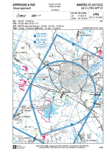


LFRS - Nantes Atlantique
Located in Nantes, France
ICAO - LFRS, IATA - NTE
Data provided by AirmateGeneral information
Coordinates: N47°9'25" W1°36'28"
Elevation is 90 feet MSL.
Magnetic variation is -0.08° East View others Airports in Pays-de-la-Loire
Operational data
Special qualification required
Current time UTC:
Current local time:
Weather
METAR: LFRS 221230Z AUTO 27011KT 240V310 9999 SCT036 BKN045 BKN058 19/11 Q1014 TEMPO 3000 SHRA BKN030CB
TAF: TAF LFRS 221100Z 2212/2318 25008KT 9999 SCT035 BKN075 TEMPO 2212/2215 3000 SHRA BKN030CB TEMPO 2308/2312 3000 SHRA BKN025CB PROB30 TEMPO 2312/2318 -SHRA SCT030CB
Communications frequencies: [VIEW]
Runways:
| RWY identifier | QFU | Length (ft) | Width (ft) | Surface | LDA (ft) |
| 03 | 27° | 9524 | 148 | MACADAM | 9360 |
| 21 | 207° | 9524 | 148 | MACADAM | 8829 |
Airport contact information
Address: Nantes France


