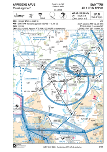


LFLN - Saint Yan
Located in Saint-Yan, France
ICAO - LFLN, IATA - SYT
Data provided by AirmateGeneral information
Coordinates: N46°24'24" E4°1'16"
Elevation is 797 feet MSL.
Magnetic variation is 1.59° East View others Airports in Burgundy
Operational data
Special qualification required
Current time UTC:
Current local time:
Weather
METAR: LFLN 160700Z AUTO 28004KT 240V320 9999 OVC047 12/10 Q1008 NOSIG
TAF: TAF LFLN 160500Z 1606/1615 VRB02KT 9999 SCT040 PROB30 TEMPO 1609/1615 3000 SHRA SCT030TCU
Communications frequencies: [VIEW]
Runways:
| RWY identifier | QFU | Length (ft) | Width (ft) | Surface | LDA (ft) |
| 15 | 148° | 2362 | 230 | GRASS | 2362 |
| 33 | 328° | 2362 | 230 | GRASS | 2362 |
| 15R | 148° | 3937 | 98 | ASPH | 3937 |
| 33L | 328° | 3937 | 98 | ASPH | 3937 |
| 15L | 148° | 6673 | 148 | ASPH | 6673 |
| 33R | 328° | 6673 | 148 | ASPH | 6673 |
Airport contact information
Address: Saint-Yan France
Handlers

Other aviation service providers
Aviation club (not for profit)

Aéroclub Louis Notteghem St Yan
Aéroclub Louis Notteghem St Yan
aeroclub@aeroclub-styan.fr+33385887026