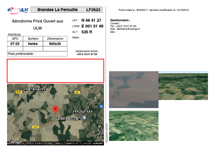


LF3623 - Brandes La Perouille
Located in Chasseneuil, France
ICAO - , IATA -
Data provided by AirmateGeneral information
Coordinates: N46°41'27" E1°31'49"
Elevation is 535 feet MSL.
View others Airports in Centre
Operational data
Special qualification required
Current time UTC:
Current local time:
Weather at : LFLX - Chateauroux Deols ( 24 km )
METAR: LFLX 171130Z AUTO 08007KT 050V110 9999 FEW034/// SCT040/// OVC090/// //////CB 17/11 Q1010 NOSIG
Communications frequencies: [VIEW]
Runways:
| RWY identifier | QFU | Length (ft) | Width (ft) | Surface | LDA (ft) |
| 07 | 0° | 1968 | 98 | GRASS | |
| 25 | 0° | 1968 | 98 | GRASS |
Airport contact information
Address: Chasseneuil France